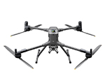
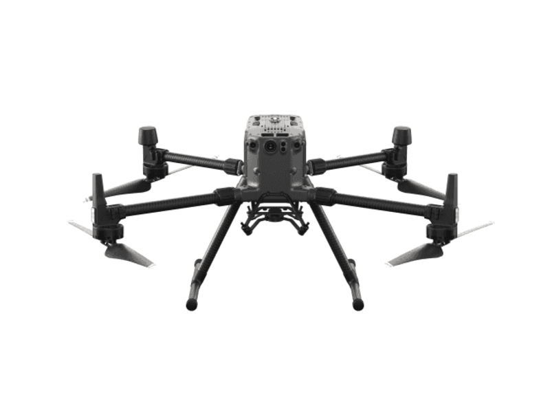
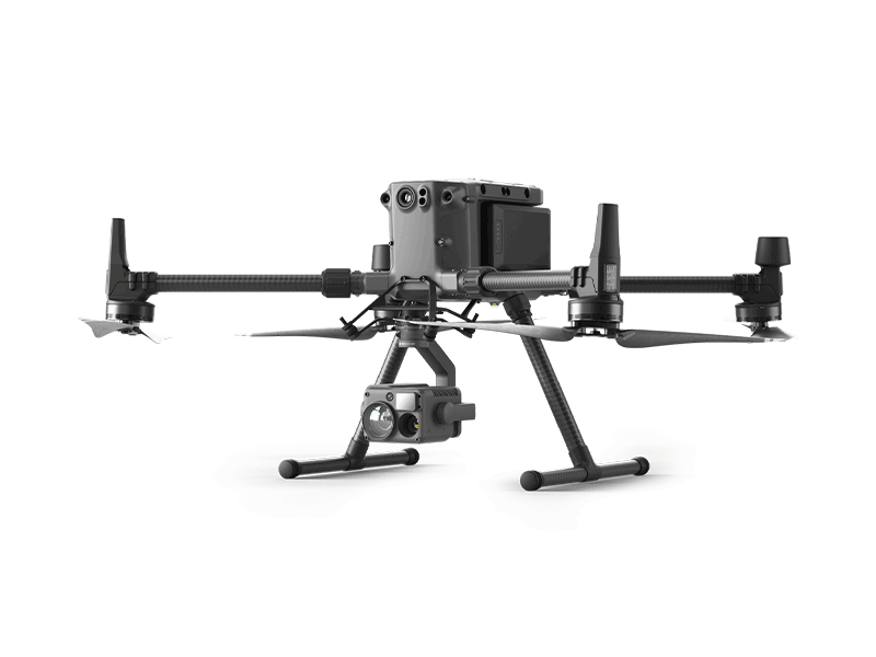
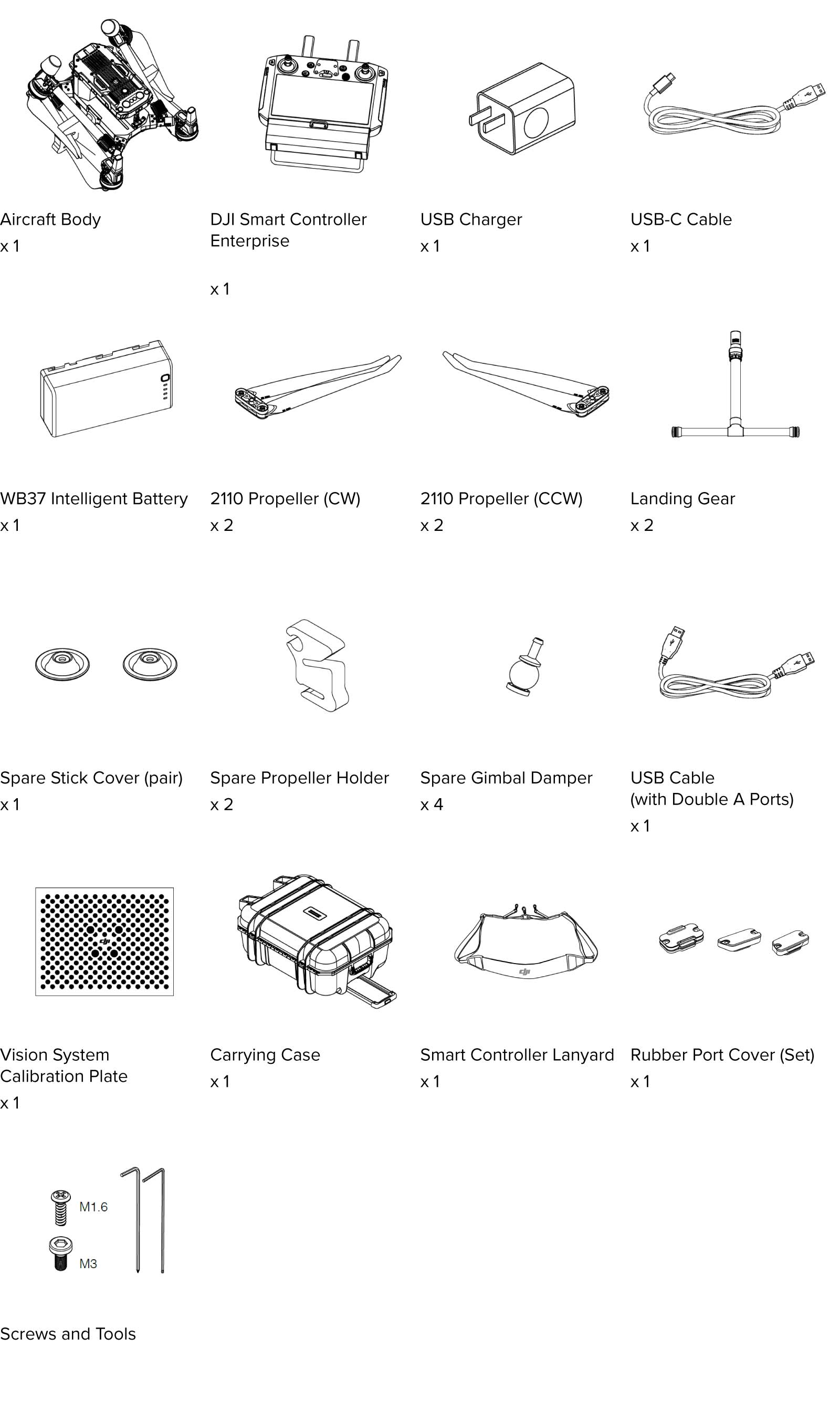
| M300 RTK |
Specs/Features |
| Diagonal Wheelbase |
895mm |
| Packing Box Size |
735mm×591mm×342mm |
| Dimensions(Folded, propellers included) |
430mm×420mm×430 mm
|
| Max Takeoff Weight |
9 kg
|
| Max Payload |
2.7 kg
|
| Hovering Accuracy (GPS) |
Vertical=± 0.5 m, Horizontal=± 1.5 m |
| Hovering Accuracy (Downward Vision) |
Vertical=± 0.1 m, Horizontal=± 0.3 m |
| GNSS |
GPS+GLONASS+BeiDou+Galileo |
| RTK |
The aircraft supports RTK positioning and orientation capabilities, and can fly safely in an environment where the compass is interferenced. |
| Hovering Accuracy (RTK) |
Vertical=± 0.1 m, Horizontal=± 0.1 m |
| Max Ascent Speed |
6 m/s
|
| Max Descent Speed |
5 m/s
|
| Max Descent Speed (tilt) |
7 m/s
|
| Max Speed |
23 m/s
|
| High Altitude Propeller |
Aircraft supports to be equipped with High Altitude Propeller, can fly in high altitude application scenarios with low flight noise. |
| Max Service Ceiling Above Sea Level |
7000 m (with 2195 propellers) |
| Max Wind Resistance |
15 m/s
|
| Max Flight Time (without payload) |
55 min
|
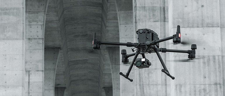
| Hardware Architecture Design |
Folding design. Support to be unfolded and taken off in 3 minutes. |
| Operating Temperature |
-20°C to 50°C |
| Vision System |
The aircraft is equipped with binocular vision systems on the front, back, up, down, left and right ride. When nearby obstacle is detected, the aircraft can prompt a warning message through the ground station software; When the distance to the obstacle is very close, the aircraft is able to actively brake.
|
| Vision System |
Forward/Backward/Left/Right: 0.7-40m
Upward/Downward: 0.6-30m |
| Infrared ToF Sensing System |
The aircraft supports 6 Directional (front, back, up, down, left and right ride) TOF sensor. |
| Landing protection |
During autonomous landing process, drone can detect the below terrain. When the terrain is uneven ground or water surface, aircraft keeps hovering, and at the same time sends a warning message to the user through the ground station software
|
| Redundancy Sensor |
Aircraft supports dual IMU, dual barometer and dual compass |
| FPV Camera |
The aircraft is equipped with FPV camera, resolution is 960p |
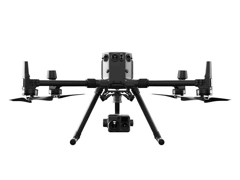
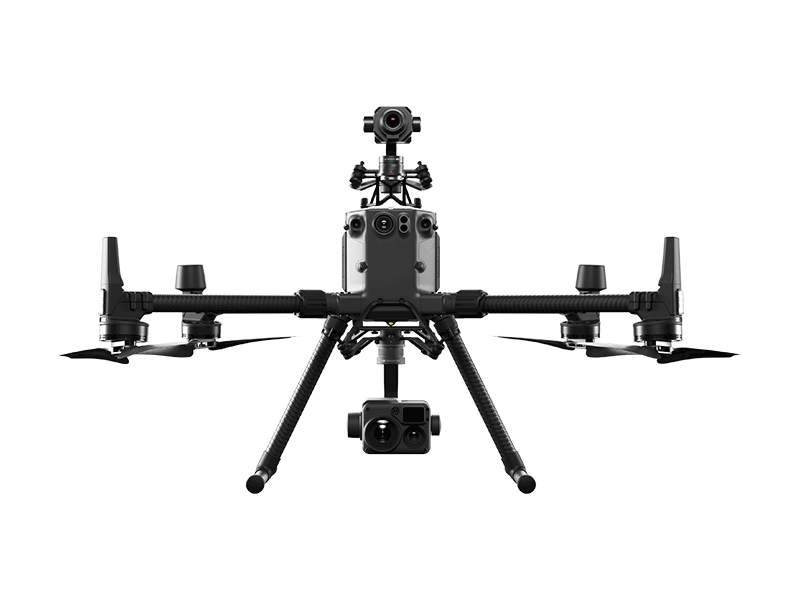
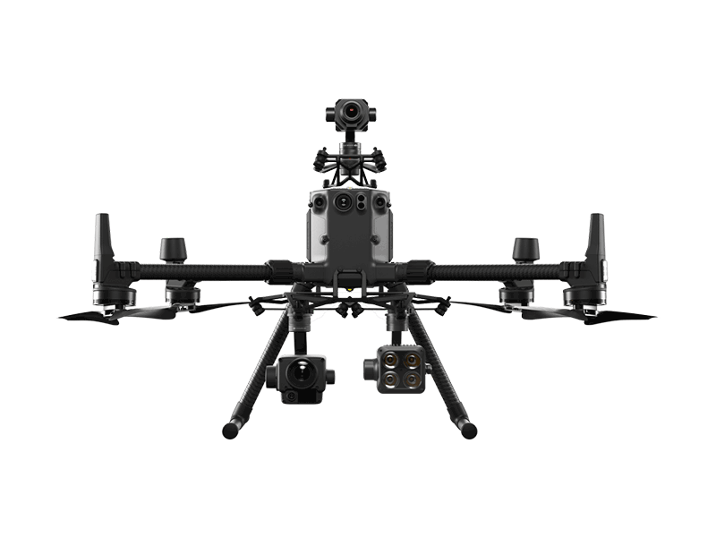
| Dual Downward Gimbals |
Aircraft supports to be equipped with Dual Downward Gimbals |
| Single Upward Gimbal |
Aircraft supports to be equipped with upward gimbal |
| Ingress Protection Rating |
IP45 |
| Beacon |
Support Beacon, and pilot can control the Beacon on-off through App, to improve the flight safety at night |
| Discreet Mode |
Support to turn off arm LEDs to perform covert tasks |
| Encrypted video transmission |
Video transmission link is encrypted by AES-256 algorithm |
| Max Transmitting Distance (unobstructed, free of interference)
|
15 km(FCC)
|
| Video Transmission Resolution |
Support 1080p Video Transmission |
| Dual-band Transmission Link |
Support 2.4GHz and 5.8GHz dual-band transmission link, when one channel is blocked, the aircraft should be able to switch to another channel for transmmission |
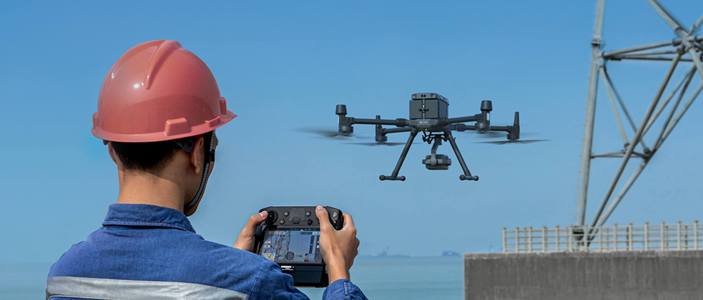
| Remote Controller |
|
| Remote Controller |
Remote controller supports to receive FPV camera view and main gimbal camera view simultaneously.
|
| Remote Controller |
The remote controller supports both built-in battery and external replaceable battery
|
| Remote Controller |
The remote controller supports 5.5-inch display screen with a resolution of 1080p, brightness of at least 1000 cd/m2 |
| Remote Controller |
Support to output camera view or remote controller screen view, through HDMI interface
|
| Remote Controller |
Support to connect Android/iOS tablet |
| Software Function |
|
| AirSense |
Able to receive ADS-B broadcast information of civil aviation passenger aircraft, and can send warning message about nearby civil aviation passenger aircraft to user through ground station software |
| Advanced Dual Control |
Aircraft supports to be connected with two remote controllers simultaneously. Both of the two remote controllers can be used to control the aircraft and the gimbal.
The control authority can be flexibly switched between the two remote controllers. Besides, if the aircraft control authority is locked with one remote controller, the other remote controller cannot obtain this authority unless it is unlocked. |
| Primary Flight Display |
The ground station software can display real-time information about aircraft speed, altitude, orientation, and gimbal orientation, etc. |
| Primary Flight Display |
The ground station software can display wind speed and direction in real time |
| Primary Flight Display |
The ground station software can display the map of obstacle in the front, rear, left, and right of aircraft. It support to set obstacle warining distance, and provide voice reminders when there are obstacles within the distance. |
| Hot-swappable Battery |
The aircraft supports hot-swappable batteries. No need to power on and power off the aircraft during battery replacement. |
| Health Management System |
The aircraft can record the total flight time, total flight times, and total flight distance, accumulated from factory date. The records can be viewed through the remote controller APP. |
| Health Management System |
The remote controller APP can display the health status of key aircraft modules and save abnormal records. |
| Waypoint 2.0 |
Mark waypoints on the map, and then edit the waypoint actions and flight route altitude, speed and other parameters to achieve automatic flight. |
| Waypoint 2.0 |
The flight route can be saved as KML file, which can be imported and exported. |
| Waypoint 2.0 |
Waypoint height can be set as absolute height/ relative height |
| Waypoint 2.0 |
Support to take pictures and videos by multiple gimbals, at the same waypoint. |
| Waypoint 2.0 |
It support to add no less than 10,000 waypoints in a single flight route. |
| Waypoint 2.0 |
It supports to record the current position of the aircraft as a waypoint, and set the flight speed and altitude, plan the flight mission. |
AI Spot-Check
|
It supports recording a flight mission through the remote controller APP, frame the object of interest on the photos taken during the flight mission. When the flight mission is executed in next time, the aircraft supports advanced algorithms to detect and find the object of interest and take precise pictures, to realized consistent photo acquisition.
Besides, it supports to check the photos on the remote controller APP. |
| Smart Track |
The aircraft can automatically adjust gimbal, to tack a defined object such as vehicles, people, and boats. Besides, the system can automatically identify vehicles, people, and boats. Pilot can also manually select interest targets. |
| Smart Track |
It supports gimbal follow mode and gimbal free mode. In gimbal follow mode, track the target by adjusting aircraft orientation. In gimbal free mode, track the target by adjusting gimbal orientation. |
| Smart Track |
It supports auto-zoom function, which helps to keep the subject centered in the frame for optimal viewing |
| Smart Track |
Support user to pin a point using laser rangefinder, this point can be shown on the map of remote controller, camera view, FPV camera view, and the map of UAV management platform. It can also be shared to third-party applications. |
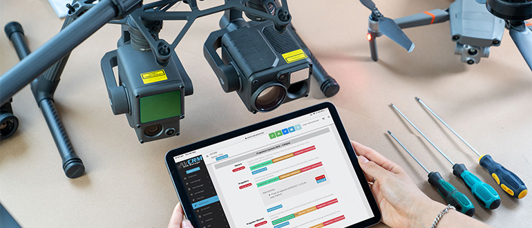
| UAV Management Platform |
The aircraft can be connected to UAV management platform. It supports to login the platform, check the position and flight parameters of multiple drones, check the historical flight records, manage drones and fleets. |
| Limit Flight Height and Distance |
Support to set the limitation of flight height and flight distance, through the remote controller APP. |
| Precision Landing |
Support accurately land to take-off point, with one click. |
| Low Battery Return to Home |
The battery level is shown on the ground station software in real time. When the battery level is low, the ground station software can provide warnings, to inform the user to perform return-to-home. If the user does not response within the given time, the aircraft will automatically return home. |
| Battery Level Display |
Support display current aircraft battery level and remaining flight time on remote controller APP. Prompt low battery warning information for user. |
| Failsafe Return to Home |
When the remote controller and aircraft are disconnected during the flight, the aircraft can automatically terminate the flight mission and return to home. During the return flight, if the connection between aircraft and remote controller comes to normal, user can cancel the return to home mission, through the remote controller. |
| ESC Buzzing |
Support to turn on the ESC buzzing function through the remote controller APP, to find the aircraft in unexpected situations. |
| Aerial Photography |
Support to plan aerial photography flight mission through remote controller APP. According to the selected survey area and camera parameters set by the user, the flight mission can be automatically planned by remote controller APP. Pilot can perform the mission for aerial photography. Besides, the flight mission can be saved locally. |
| Aerial Photography |
It supports importing the captured photos into 2D and 3D reconstruction software on the computer, to generate 2D map and 3D model of the photographed area. |
| SDK Capability |
Support development kit for mobile terminal, on-board equipment, and 3rd party payload. It also supports power supply and communication interface, for 3rd party secondary development and integration. |
| Intelligent Battery |
|
| Battery Station |
The battery station should support multiple battery ports to charge up to eight aircraft batteries and four remote controller batteries. |
| Battery Station |
The battery station should be equipped with a portable lever |
| Battery Station |
The battery station is equipped with LED indicator and buzzer to indicate battery status and alarm. |
| Charging Speed |
Charge 2 batteries to full capacity within 1 hour |
| Pairing Batteries |
The aircraft is designed with dual batteries. If two batteries with a significant difference in battery life are installed and powered on, a prompt will pop up in the ground station software, to recommend user to replace the batteries to a pair with similar performance. |
| Dual Battery |
In the event that one battery fails, the drone can still return home safely with the other battery.
|
| Self-discharge |
In the case that the battery power level is high, and its storage time is longer than the Self-Discharge time (can be set as 1 day to 10 days), then the battery will automatically be discharged to 60% in order to protect battery and extend battery life. |
| Battery Level Display |
The battery supports indicator, which can display the current battery level. |
| Overvoltage Charging Protection |
Support overcharge protection function. If the charging voltage is too high, the charging device can disconnect the charging circuit. |
| Overcurrent Charging Protection |
Support overcharge protection function. If the charging current is too large, the charging device can disconnect the charging circuit. |
| Battery Self-heating |
When operating in low-temperature conditions, the battery will automatically warm up after power on if it is installed into the aircraft. |
| Over-discharge Protection |
When the battery voltage drops to a certain value, the battery can stop discharging.
|
| Cell Damage Detection |
If the battery cell is damaged or the cells are seriously unbalanced, groud station software can prompt warning information for user. |

 DJI Mavic 4 Pro Creator Combo (512GB)
 DJI Mavic 4 Pro Fly More Combo
 DJI Mavic 4 Pro
 DJI Care Refresh 1-Year Plan (DJI Mavic 3 Pro)
 DJI Care Refresh 2-Year Plan (DJI Mavic 3 Pro)
 DJI Care Refresh 1-Year Plan (DJI Mavic 3 Pro Cine)
 DJI Care Refresh 2-Year Plan (DJI Mavic 3 Pro Cine)
 DJI Mavic 3 Series 100W Battery Charging Hub
 DJI Mavic 3 Series Intelligent Flight Battery
 DJI Mavic 3 Classic Storage Cover
 DJI Power SDC to DJI Mavic 3 Series Fast Charge Cable
 DJI Mavic 3
  DJI Mavic 3 Fly More Combo
  DJI Mavic 3 Cine Premium Combo (Open Box)
 Mavic 2 Pro (Drone Only, No Battery)
 Mavic 2 Zoom (Drone Only)
 Ex-Demo Mavic 2 Zoom
 Mavic 2 Pro
 SunnyLife Low-Noise Propellers for Mavic Pro (2 Pairs)
 CrystalSky Mavic/Spark Remote Controller Mounting Bracket
 D1 Aircraft Sleeve
 PolarPro CrystalSky Mount for Mavic Series
 DJI Air 3S
 DJI Air 3S Fly More Combo w. DJI RC-N3
 DJI Air 3S Fly More Combo w. DJI RC 2
 DJI Air 3 Fly More Combo w. DJI RC 2
 DJI Air 3 Fly More Combo
 Ex-Demo DJI Air 2S
 DJI Air 2S Fly More Combo
 GPC Safety Case V2 for Mavic Air 2
 DJI Smart Controller
  Mavic Air 2 Battery to Power Bank Adaptor
 DJI RC-N Series Remote Controller Monitor Hood
 Mavic Air (Arctic White)
 DJI Mini 5 Pro Fly More Combo
 DJI Mini 5 Pro Fly More Combo Plus
 DJI Mini 5 Pro
 DJI Mini 5 Pro Fly More Combo w. DJI RC-N3
 DJI Mini 4 Pro Fly More Combo (Refurbished)
 DJI Mini 4 Pro Fly More Combo Plus (Refurbished)
 DJI Care Refresh 1-Year Plan (DJI Mini 3)
 DJI Care Refresh 2-Year Plan (DJI Mini 3)
 DJI RC
 DJI Mini 4 Pro/Mini 3 Series Two-Way Charging Hub
 DJI Care Refresh 1-Year Plan (DJI Mini 2 SE & DJI Mini 4K)
 DJI Mini 2 / SE Intelligent Flight Battery
 DJI Care Refresh 2-Year Plan (DJI Mini 2 SE & DJI Mini 4K)
 PGYTECH Lens Hood for DJI Mini Series
 DJI Mini 3 Pro w. DJI RC
  DJI Mini 3 Pro (Drone Only, No Battery)
 PGYTECH Control Stick Protector for Mavic Mini
 Mavic - RC Cable (Reverse Micro USB connector)
 Mavic - RC Cable (Standard Micro USB connector)
 Ex-Demo DJI Mini 2 / SE Intelligent Flight Battery
 Mavic Mini Remote Controller (open box)
 DJI Lito X1 Fly More Combo
 DJI Lito X1 Fly More Combo Plus
 DJI Lito X1
 DJI Lito X1 Fly More Combo (DJI RC-N3)
 DJI Lito 1
 DJI Lito 1 Fly More Combo
 DJI Flip (Drone Only, No Battery)
 DJI Flip
 DJI Flip w. DJI RC 2
 DJI Flip Fly More Combo
 DJI Care Refresh 1-Year Plan (DJI Flip)
 DJI Care Refresh 2-Year Plan (DJI Flip)
 DJI RC 2
 DJI RC-N3 Remote Controller
 DJI RC/RC 2 Control Sticks
 D1 Labs Screen Protector for DJI RC Series
 D1 Lens Cloth
 D1 Labs Heavy Duty Lanyard
 D1 Labs Monitor Hood for DJI RC-N Series
 D1 Labs Lanyard Kit for DJI RC-N Series
 D1 Labs 100W Braided USB-C Cable
 D1 Labs Lunar Glow USB-C Cable
 SanDisk Extreme Pro 1TB 200MB/s MicroSD Card
 Lexar Professional 128GB Silver Plus MicroSD Card
 DJI Neo 2 (Drone Only)
 DJI Neo 2 Fly More Combo (Drone Only)
 DJI Neo 2 Fly More Combo
 DJI Neo 2 Motion Fly More Combo
 DJI Neo
 DJI Neo Fly More Combo
 Ex-Demo DJI Neo
 Ex-Demo DJI Neo Fly More Combo
 DJI Avata 360 Fly More Combo
 DJI Avata 360 Motion Fly More Combo
 DJI Avata 360 (Drone Only)
 DJI Avata 360 w. DJI RC 2
 DJI Avata 2 Fly Smart Combo
 DJI Avata 2 Fly Smart Combo (Three Batteries)
 DJI Avata 2 Fly More Combo
 DJI Avata 2 Fly More Combo (Three Batteries)
 DJI FPV Goggles V2 Motion Combo
 DJI FPV Goggles V2
 DJI Goggles 3
 DJI Goggles N3
 DJI O4 Air Unit
 DJI O4 Air Unit Pro
 DJI Avata (Drone Only, No Battery)
 DJI Avata Intelligent Flight Battery
 DJI Avata Propeller Guard
 SunnyLife Propeller Guard Protector for DJI Avata
 DJI O3 Air Unit
 DJI FPV Remote Controller 3
 DJI O3 Air Unit 3-in-1 Cable
 DJI FPV Combo
  Osmo Pocket 4 Standard Combo
 Osmo Pocket 4 Creator Combo
 Osmo Action 6 Standard Combo
 Osmo Action 6 Adventure Combo
 DJI Mic Mini 2 Dual Microphone Combo
 DJI Mic Mini 2 Single Microphone Kit
  DJI Mic Mini 2 Dual Microphone Combo (Mobile)
 DJI Mic Mini 2 Single Microphone Kit (Mobile)
 Osmo Nano Standard Combo (64GB)
 Osmo Nano Standard Combo (128GB)
 Osmo 360 Standard Combo
 Osmo 360 Adventure Combo
 Osmo Mobile 8P Standard Combo
 Osmo Mobile 8P Advanced Tracking Combo
 Osmo Mobile 8P Creator Combo
 Osmo Mobile 8 Advanced Tracking Combo
 Osmo Pocket 3 Standard Combo
 Osmo Pocket 3 Creator Combo
 Osmo Pocket 3 (Refurbished)
 Osmo Pocket 3 Creator Combo (Refurbished)
 Osmo Action 5 Pro Standard Combo
 Osmo Action 5 Pro Adventure Combo
 DJI Mic 3 Dual Microphone Combo
 DJI Mic 3 Single Microphone Kit
 DJI Mic Mini Single Microphone Kit
 DJI Mic Mini Transmitter (Arctic White)
 Osmo Action 4 Standard Combo
 Osmo Action 4 Adventure Combo
 DJI Mic 2 Single Microphone Kit
 DJI Mic 2 Transmitter (Shadow Black)
 DJI Mic 2 Transmitter (Pearl White)
 DJI Care Refresh 2-Year Plan (DJI Pocket 2)
 Osmo Pocket 3.5mm Adapter
 Freewell Light Pollution Reduction Filter for Osmo Action Series
 Freewell Glow Mist 1/4 for Osmo Action 3/4/5 Pro
 DJI Care Refresh 1-Year Plan (Osmo Action 3)
 DJI Care Refresh 2-Year Plan (Osmo Action 3)
 DJI Mic Single Microphone Kit
 DJI Action 2 Dual Screen Combo
 DJI Osmo Action
  Osmo Pocket
 DJI RS 5
 DJI RS 5 Combo
 DJI RS 4 Pro Combo (2026)
 DJI RS 4 Mini
 DJI RS 4 Mini Combo
 DJI RS 4
 DJI RS 3 Mini
 DJI RS 3
 DJI RS 3 Pro
 DJI RS 2
 DJI RS 2 Pro Combo
 DJI RSC 2
 DJI RSC 2 Pro Combo
 Ronin-S
 Ronin-SC
 Ronin 4D-6K
 Ronin 4D-8K
 DJI Inspire 3 Basic Package
 DJI Inspire 3
 DJI Focus Pro Creator Combo
 DJI Focus Pro All-In-One Combo
 DJI Transmission (High-Bright Monitor Combo)
 DJI Transmission (Standard Combo)
 DJI Video Transmitter
 DJI Video Receiver
 DJI SDR Transmission Combo
 DJI SDR Transmission Receiver
 DJI SDR Transmission Transmitter
 Inspire 2
 Ex-Demo Inspire 2
 DJI Power 1000 Mini
 DJI Power 2000
 DJI Power 1000 V2
 DJI Power 1000 Portable Power Station
 DJI Power Expansion Battery 2000
 DJI Power Dongle
 IBCPOWER 100W Foldable Solar Panel
 DJI Power Expansion Battery 2000 Mounting Kit
 DJI Power Series Hand Truck
 DJI Power SDC to XT60 Power Cable (12V)
 DJI Power MC4 to XT60 Solar Power Cable
 UGREEN Braided USB-C to USB-C Cable (1 Metre)
 DJI Power SDC to DJI Inspire 3 Fast Charge Cable
 Zignes 120W Solar Panel
 DJI Power Solar Panel Adapter Module (MPPT)
 DJI ROMO S (Water Tank Version)
 DJI ROMO P (Water Tank Version)
 DJI ROMO A (Water Tank Version)
 ROMO Accessory Kit
 ROMO Cleaning Solution
 ROMO Side Brush
 ROMO Mop Pad
 Matrice 30T Dock Bundle
 NextCore RN50 Drone LiDAR
 Cendence-S Remote Controller For M200 V2 Series
 Zenmuse H30
 Zenmuse H30T
 ParaZero SafeAir Parachute for Matrice 30 Series
 ParaZero SafeAir Parachute for DJI Mavic 3 Series (ASTM Compliant)
 DJI Dock 2
 DJI Matrice 4E
 DJI Matrice 4T
 DJI Matrice 4D
 DJI Matrice 4D Combo
 DJI Matrice 4TD
 DJI Matrice 4TD Combo
 DJI Matrice 400
 DJI Dock 3
 DJI Mavic 3 Thermal Advanced
 DJI Mavic 3 Multispectral
 DJI FlyCart 30
 DJI FlyCart 100
 Zenmuse L2
 Zenmuse P1
 Phase One P3 Payload (iXM 120MP) with 80mm AF
 Deepthink S2 Pro Night Vision Payload
 Mavic 2 Enterprise Advanced
 Matrice 30T
 Matrice 300 RTK
  Deepthink S2 Night Vision Payload for Matrice 300 Series
 Zenmuse H20T
  DJI Care Enterprise Plus (DJI Matrice 400)
 DJI Care Enterprise Plus (DJI Matrice 4E)
 DJI Maintenance Program Basic Service (Matrice 300 RTK)
 DJI Maintenance Program Standard Service (Mavic 2 Series)
 DJI Maintenance Program Standard Service (Matrice 300 RTK)
 DJI AGRAS T100
 AGRAS T50
 DJI RC Plus for AGRAS Series
 DJI AGRAS T25P
 AGRAS T25
 AGRAS T40 (Drone Only, No Batteries)
 DJI AGRAS T30 (Excluding Batteries)
 X2D II 100C
 907X & CFV 100C
 XCD 45P
 XCD 2,5/25V
 XCD 2,5/38V
 XCD 2,5/55V
 UGREEN 145W 25000mAh Power Bank
 Freewell Pro Card Reader (CF A/B, SD, TF)
 LiPO Battery Safe Bag (Medium)
 D1 Labs Landing Pad Pro (50CM)
 Lexar Professional 256GB Silver Plus MicroSD Card
 D1 Labs High-Speed SD Card Reader
 DJI Care Refresh 1-Year Plan (DJI Mini 5 Pro)
 DJI Care Refresh 2-Year Plan (DJI Mini 5 Pro)
 D1 Labs Safety Case for DJI Mini 5 Pro
 DJI Mini 5 Pro Shoulder Bag
 DJI Care Refresh 1-Year Plan (DJI Neo)
 DJI Care Refresh 2-Year Plan (DJI Neo)
 DJI Care Refresh 1-Year Plan (Osmo Pocket 3)
 DJI Care Refresh 2-Year Plan (Osmo Pocket 3)
 D1 Labs Carry Case for Osmo Pocket 3
 Osmo Pocket 3 Carrying Bag
 DJI OM Magnetic Phone Clamp 5
 DJI Care Refresh 1-Year Plan (Osmo Mobile 7P)
 DJI OM 7 Series Tracking Kit
 DJI Care Refresh 1-Year Plan (Osmo Mobile 7)
 Osmo 1.6m Tripod Selfie Stick
 DJI OM 7 Series Magnetic Phone Clamp
 DJI Care Refresh 1-Year Plan (DJI RS 4 Mini)
 DJI Care Refresh 2-Year Plan (DJI RS 4 Mini)
 DJI RS Enhanced Intelligent Tracking Module
 DJI RS Intelligent Tracking Module
 DJI Care Refresh 1-Year Plan (DJI Mini 4 Pro)
 DJI Care Refresh 2-Year Plan (DJI Mini 4 Pro)
 DJI Care Refresh 1-Year Plan (DJI Air 3S)
 DJI Care Refresh 2-Year Plan (DJI Air 3S)
 DJI RC Pro 2
 DJI Care Refresh 1-Year Plan (DJI RS 4)
 DJI Care Refresh 2-Year Plan (DJI RS 4)
 DJI Care Refresh 1-Year Plan (Osmo Action 5 Pro)
 DJI Care Refresh 2-Year Plan (Osmo Action 5 Pro)
 Osmo Action Carrying Bag
 DJI Care Refresh 1-Year Plan (DJI Mavic 4 Pro)
 DJI Care Refresh 2-Year Plan (DJI Mavic 4 Pro)
 PGYTECH OneGo Air Backpack 25L | Obsidian Black
 D1 Labs Safety Case for DJI Mavic 4 Pro
 DJI Care Refresh 1-Year Plan (DJI RS 4 Pro)
 DJI Care Refresh 2-Year Plan (DJI RS 4 Pro)
 DJI Care Refresh 1-Year Plan (Osmo Action 4)
 DJI Care Refresh 2-Year Plan (Osmo Action 4)
 DJI Mic 3 Receiver
 DJI Mic 3 Transmitter
 DJI Mic 3 Charging Case
 DJI Mic Series Mobile Receiver
 DJI Mic Series Carrying Pouch
 DJI Mic Mini Windscreen (Black & Grey w. Black Clip)
 DJI Care Refresh 1-Year Plan (Osmo Nano)
 DJI Care Refresh 2-Year Plan (Osmo Nano)
 D1 Labs Screen & Lens Protector for Osmo Nano
 Osmo 70cm Invisible Selfie Stick
 DJI Care Refresh 1-Year Plan (Osmo 360)
 DJI Care Refresh 2-Year Plan (Osmo 360)
 Osmo 360 Carrying Bag
 D1 Labs Screen Protector for Osmo 360
 D1 Labs USB-C Wrist Strap Cable
 UGREEN 200W USB-C Charging Station
 UGREEN FineTrack Smart Finder
 UGREEN 65W Nexode S GaN Charger
 D1 Labs Landing Pad Pro (65CM)
 D1 Labs Landing Pad Pro (100CM)
 D1 Labs Weighted Drone Landing Pad (92 cm)
 D1 Labs Dual Hook Controller Lanyard
 D1 Labs Screen Protector for DJI RC Pro
 SunnyLife Carrying Case for DJI RC Pro
  SunnyLife Protective Cover for DJI RC Pro
 SunnyLife Sun Hood for DJI RC Pro
 D1 Labs Drone Safety Sign
 D1 Labs Retractable Safety Cone (450 mm)
 LiPO Battery Safe Bag (Large)
 Freewell ND1000 Filter for Osmo Nano
 Freewell Snow Mist 1/4 Filter for Osmo Pocket 3/4
 Freewell Glow Mist 1/4 Filter for Osmo Nano
 Freewell 1/8 Mist Filters for Osmo Pocket 3/4 (2 Pack)
 Freewell Galaxy Series Snow Mist 1/4 Filter
 Freewell Sherpa Series Case for iPhone 13 Pro
 Freewell Sherpa Series Case for iPhone 13 Pro Max
 Phantom 4 Pro V2.0 Remote Controller
  DJI RC Motion 3
 Cynova Protective Cover for DJI RC Pro 2
 D1 Labs Screen Protector for DJI RC Pro 2
 D1 Labs Lanyard Bracket for DJI RC Pro 2
 DJI Care Refresh 1-Year Plan (DJI Avata 2)
 DJI Care Refresh 1-Year Plan (DJI Neo 2)
 DJI Care Refresh 1-Year Plan (DJI RS 5)
 DJI Care Refresh 2-Year Plan (DJI Neo 2)
 DJI Care Refresh 2-Year Plan (DJI RS 5)
 DJI Care Enterprise Basic (D-RTK 3 Multifunctional Station)
 DJI Care Enterprise Basic (DJI Mavic 3 Enterprise)
 DJI Care Enterprise Basic (Zenmuse S1)
 DJI Care Enterprise Basic (Zenmuse V1)
 DJI Care Enterprise Basic 2-Year Plan (D-RTK 3 Multifunctional Station)
 DJI Care Enterprise Basic 2-Year Plan (Zenmuse S1)
 DJI Care Enterprise Basic 2-Year Plan (Zenmuse V1)
 DJI Care Enterprise Basic 2-Year Plan (Zenmuse L2)
 DJI Care Enterprise Plus (Zenmuse P1)
 DJI Care Enterprise Plus (DJI Matrice 4T)
 Ex-Demo DJI Mini 3 (DJI RC-N1)
 Ex-Demo DJI Mini 3 Fly More Combo Plus
 Ex-Demo Osmo Pocket 3 Creator Combo
 Ex-Demo DJI Neo 2 Fly More Combo (Drone Only)
 CrystalSky Monitor Hood (For 7.85 Inch)
 Ex-Demo DJI Mic Mini Dual Microphone Combo
 Ex-Demo DJI Mic Mini Transmitter (Arctic White)
 Ex-Demo DJI Mic Mini Transmitter (Infinity Black)
 Ex-Demo DJI Mic 2 Single Microphone Kit
 Ex-Demo DJI Mic 2 Transmitter (Pearl White)
 Ex-Demo DJI OM Fill Light Phone Clamp
 Ex-Demo WB37 Intelligent Battery
 Ex-Demo DJI Mic 3 Transmitter
 Ex-Demo Mavic 2 Enterprise Zoom
 Ex-Demo DJI Matrice 4D
  Ex-Demo DJI Matrice 4D Combo
 Ex-Demo DJI DL-S 16mm F2.8 ND ASPH Lens
 Ex-Demo TB60 Intelligent Flight Battery
 Ex-Demo ChengZhi FL48 Lighting System
 Ex-Demo Zenmuse P1
 Ex-Demo Zenmuse X5S
 Ex-Demo Zenmuse X7
 Ex-Demo Wingsland Z15 Gimbal Spotlight