GPC Safety Case for Phantom 4 RTK
 Zenmuse L2
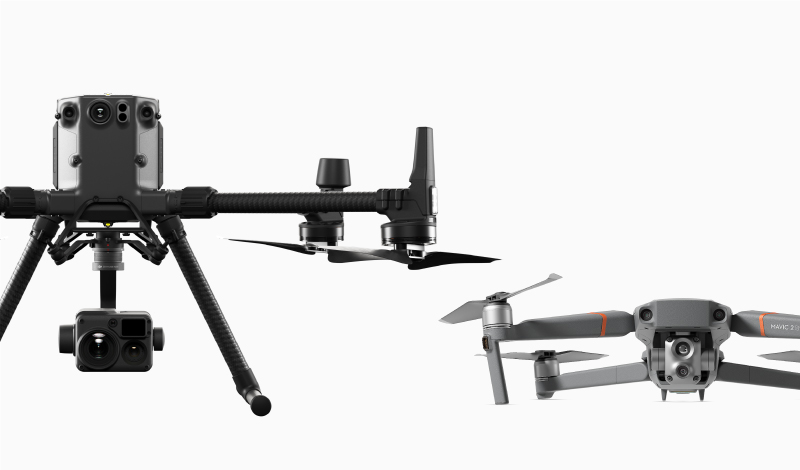
 Ex-Demo Mavic 2 Enterprise Dual w. DJI Smart Controller
 NextCore RN50 Drone LiDAR
 D1 Labs Safety Case for DJI D-RTK 2
 Zenmuse H30
 Zenmuse H30T
 ParaZero SafeAir for Matrice 300 Series
 DJI Dock 2
 DJI Mavic 3 Enterprise
 DJI Mavic 3 Enterprise with 2 Year Care Basic
 DJI Mavic 3 Thermal
 DJI Mavic 3 Thermal with 2 Year Care Basic
 Matrice M30
 Matrice M30T
 Matrice M30 with Enterprise Care Plus
 Matrice M30T with Enterprise Care Plus
 Matrice 350 RTK
 Zenmuse P1
 Phase One P3 Payload (iXM 120MP)
 DJI FlyCart 30
 DJI RC Plus for DJI FlyCart 30
 DJI Matrice 3D
 DJI Matrice 3TD
 DJI Dock
  AGRAS T50
 DJI RC Plus for AGRAS Series
 AGRAS T25
 DJI Power 1000
 Matrice 300 RTK
  Deepthink S2 Pro Night Vision Payload
 Deepthink S2 Night Vision Payload for Matrice 300 Series
 AGRAS T40
 DJI AGRAS T10 (Excludes Batteries)
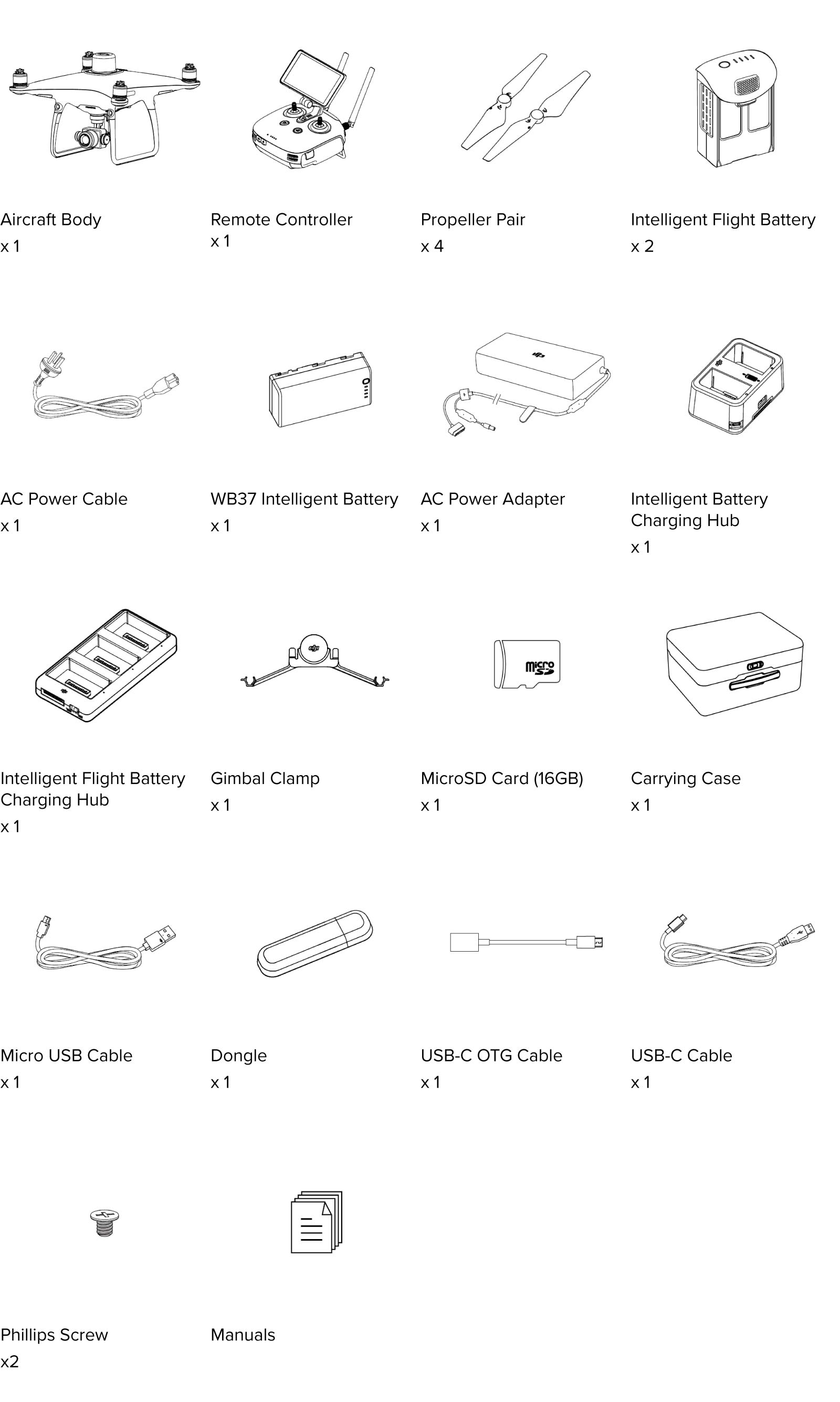
 Phantom 4 RTK (2 Battery)
 DJI D-RTK 2 High Precision GNSS Mobile Station
 Tello
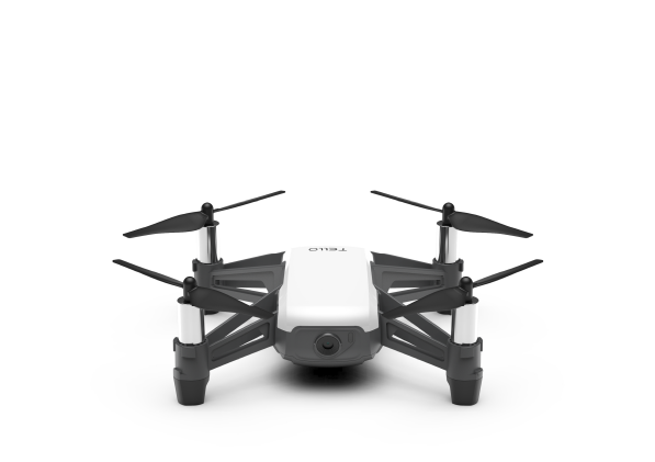
Tello Tello Boost Combo
 RoboMaster S1
 GameSir T1d Controller
 SunnyLife Carrying Case for Tello
 Tello Flight Battery
 SunnyLife Battery Charging Hub for Tello
 Sunnylife Carrying Case for RoboMaster S1
  RoboMaster S1 PlayMore Kit V2
  RoboMaster S1 Intelligent Battery V2
  RoboMaster S1 Gamepad V2
 D1 Labs Heli Pad Mouse Pad
 SanDisk Extreme Pro 128GB 200MB/s MicroSD Card
 SanDisk Extreme Pro 256GB 200MB/s MicroSD Card
 SanDisk Extreme Pro 512GB 200MB/s MicroSD Card
 DJI Mini 4 Pro Fly More Combo
 DJI Mini 4 Pro Fly More Combo Plus
 DJI Mini 4 Pro
 DJI Mini 4 Pro w. DJI RC 2
 DJI Mini 3
 DJI Mini 3 w. DJI RC
 DJI Mini 3 Fly More Combo Plus
 DJI Mini 3 Pro w. DJI RC
  DJI Mini 3 Pro
  DJI Mini 2 SE
 DJI Mini 2 SE Fly More Combo
 DJI Mini SE
  DJI Mini SE Combo
 DJI Mini 2
 DJI Mini 2 Fly More Combo
  Mavic Mini
 Mavic Mini Fly More Combo
  DJI Air 3 Fly More Combo w. DJI RC 2
 DJI Air 3
 DJI Air 3 Fly More Combo
 DJI Air 2S Fly More Combo
 Mavic Air 2 Fly More Combo
 Mavic Air 2
 DJI Mavic 3 Pro w. DJI RC
 DJI Mavic 3 Pro Fly More Combo w. DJI RC
 DJI Mavic 3 Pro Fly More Combo w. DJI RC Pro
 DJI Mavic 3 Pro Cine Premium Combo
 DJI Mavic 3 Classic w. DJI RC
  DJI Mavic 3 Classic w. DJI RC-N1
 DJI Mavic 3 Classic (Drone Only)
 DJI RC Pro Controller
 DJI Mavic 3
  DJI Mavic 3 Fly More Combo
  Mavic 2 Zoom
 Mavic 2 Pro
 Mavic Pro Fly More Combo
 DJI Avata 2 Fly More Combo
 DJI Avata 2 Fly More Combo (Three Batteries)
 DJI Avata Pro-View Combo w. DJI RC Motion 2
 DJI Avata Fly Smart Combo
 DJI Goggles 3
 DJI Goggles Integra Motion Combo
 DJI Goggles Integra
 DJI Goggles 2 Motion Combo
 Ex-Demo D1 FPV Combo
  DJI FPV Combo
  DJI O3 Air Unit
 Osmo Pocket 3 Standard Combo
 Osmo Pocket 3 Creator Combo
 Osmo Action 4 Standard Combo
 Osmo Action 4 Adventure Combo
 DJI Mic 2 Dual Microphone Combo
 DJI Mic 2 Single Microphone Kit
 Osmo Mobile 6 (Slate Grey)
 Osmo Mobile 6 (Platinum Grey)
 Osmo Mobile SE
 Osmo Action 3 Standard Combo
 Osmo Action 3 Adventure Combo
  DJI Mic Single Microphone Kit
 DJI Mic Dual Microphone Combo
 DJI Pocket 2
 DJI Pocket 2 Creator Combo
 DJI Pocket 2 Exclusive Combo | Sunset White
 DJI Action 2 Dual-Screen Combo (128GB)
 DJI Action 2 Power Combo (128GB)
 DJI Action 2 Dual Screen Combo
 DJI Action 2 Power Combo
 DJI Osmo Action
  Osmo Pocket
 DJI RS 4
 DJI RS 4 Combo
 DJI RS 4 Pro
 DJI RS 4 Pro Combo
 DJI RS 3 Mini
 DJI RS 3
 DJI RS 3 Combo
 DJI RS 3 Pro
 DJI RS 2
 DJI RS 2 Pro Combo
 DJI RSC 2
 DJI RSC 2 Pro Combo
 Ronin-S
 Ronin-SC
 Ronin 2 Professional Combo
  Ronin 4D-6K
 Ronin 4D-8K
 Zenmuse X9-8K Gimbal Camera
 DJI Ronin 4D Flex
 DJI Inspire 3
 DJI Focus Pro Creator Combo
 DJI Focus Pro All-In-One Combo
 DJI Transmission (High-Bright Monitor Combo)
 DJI Transmission (Standard Combo)
 DJI Video Transmitter
 DJI Video Receiver
 DJI SDR Transmission Combo
 DJI SDR Transmission Receiver
 DJI SDR Transmission Transmitter
 DJI DL 24mm F2.8 LS ASPH Lens
 DJI DL-S 16mm F2.8 ND ASPH Lens
 DJI DL 35mm F2.8 LS ASPH Lens
 DJI DL 50mm F2.8 LS ASPH Lens
 Inspire 2
  Inspire 2 Includes Apple ProPres & CinemaDNG Licenses
 Hasselblad Flash Sync Output Cable
 X2D 100C LFK
 H6D-100c
  XCD 3,5/120 MACRO
 UGREEN 65W Nexode GaN II Charger
 D1 Labs Landing Pad Pro (50CM)
 Caution Drone Safety Sign
 D1 Labs Air Duster Pro
 DJI Care Refresh 1-Year Plan (DJI Mini 4 Pro)
 DJI Care Refresh 2-Year Plan (DJI Mini 4 Pro)
 D1 Labs Safety Case for DJI Mini 4 Pro
 D1 Labs Carry Case for DJI Mini 4 Pro
 DJI Care Refresh 1-Year Plan (Osmo Pocket 3)
 DJI Care Refresh 2-Year Plan (Osmo Pocket 3)
 Freewell Mega Filter Pack for Osmo Pocket 3 (14 Pack)
 Freewell Creative Lens Kit for Osmo Pocket 3
 Auspicious Sky Drone Skin for DJI Air 3
 DJI Care Refresh 1-Year Plan (DJI Air 3)
 DJI Care Refresh 2-Year Plan (DJI Air 3)
 DJI RC 2
 Auspicious Sky Drone Skin for DJI Mavic 3 Series
 EM-D1 Drone Skin for DJI Mavic 3 Series
 ParaZero SafeAir for DJI Mavic 3 Series
 DJI Care Refresh 1-Year Plan (DJI Mavic 3 Pro)
 DJI Care Refresh 1-Year Plan (Osmo Action 4)
 DJI Care Refresh 2-Year Plan (Osmo Action 4)
 D1 Labs Screen & Lens Protector for Osmo Action 4
 Osmo Action Extreme Battery
 Ulanzi Magic Arm with Cold Shoe Mount
 DJI RS Focus Gear Strip
 DJI Care Refresh 1-Year Plan (DJI RS 4)
 DJI Care Refresh 2-Year Plan (DJI RS 4)
 DJI Care Refresh 1-Year Plan (DJI RS 4 Pro)
 DJI Care Refresh 2-Year Plan (DJI RS 4 Pro)
 DJI RS BG30 Battery Grip
 DJI Ronin Image Transmitter
 DJI Mic 2 Transmitter (Pearl White)
 DJI Mic 2 Transmitter (Shadow Black)
 DJI Mic 2 Camera Adapter
 DJI Lavalier Mic
 SunnyLife Action Camera Mount for DJI Avata
 DJI Care Refresh 1-Year Plan (Osmo Action 3)
 DJI Care Refresh 2-Year Plan (Osmo Action 3)
 PGYTECH CapLock Action Camera Extension Pole Tripod
 PGYTECH Quick Release Clamp for DJI RS Series
 DJI Care Refresh 1-Year Plan (DJI RS 3 Mini)
 DJI Care Refresh 2-Year Plan (DJI RS 3 Mini)
 DJI RS Extended Grip/Tripod (Metal)
 DJI Mic Mobile Phone Adapter (Lightning)
 DJI Mic Mobile Phone Adapter (USB-C)
 DJI Mic Clip Magnet
 PolarPro CrystalSky Mount | Mavic/Spark
  PolarPro Mavic 2 Pro Cinema Series 2-5 Stop VND Filter
 PolarPro Vivid Collection Filters for Mavic Air 2 (3 Pack)
 PolarPro 2 to 5 Stop VND Filter for Mavic Air 2
 EM-D1 Drone Skin for DJI Mini 3 Pro
 D1 Labs EM-D1 Desk Pad (Ultraviolet)
 UGREEN 100W USB-C Charging Station
 UGREEN 65W USB-C Charging Station
 UGREEN HiTune T3 Active Noise Cancelling Earbuds (Black)
 UGREEN HiTune T3 Active Noise Cancelling Earbuds (White)
 D1 VIP Drone Set-Up Service
 D1 Beginners Flight Training (Brunswick, VIC)
 Remote Pilots License (RePL)
  DJI Maintenance Course Training
 D1 Labs Landing Pad Pro (65CM)
 D1 Labs Landing Pad Pro (100CM)
 D1 Labs Weighted Drone Landing Pad (67CM)
 PGYTECH OneMo Lite Backpack 22L
 PGYTECH OneMo FPV Backpack
 PGYTECH OneGo Backpack 18L | Obsidian Black
 PGYTECH OneMo 2 Backpack 25L | Space Black
 DJI RC-N1/N2 Control Sticks
 SunnyLife Bicycle Mount for DJI RC-N1/N2
 PGYTECH Tablet Holder V2
 LifThor Baldur 2 Tablet Holder for DJI RC-N1/N2
 SunnyLife Rocker Speed Controller for DJI RC Series
 SunnyLife Control Sticks for DJI RC Series
 D1 Labs Screen Protector for DJI RC Series
 SunnyLife Carrying Case for DJI RC Pro
  D1 Labs Screen Protector for DJI RC Pro
 D1 Labs Lanyard Bracket for DJI RC Pro
 D1 Labs Dual Hook Controller Lanyard
 Payload Release System for DJI Air 2S / Mavic Air 2
 Payload Release System for DJI Air 3
 Payload Release System for DJI Mavic 2 Series
 Payload Release System for DJI Mavic 3 Series
 Retractable Drone Safety Cone 450mm
 SunnyLife Anti-Collision Drone Strobe Light
 PGYTECH Mantispod
 PGYTECH Mantispod Pro
 Freewell All Day Filters for Osmo Pocket 3 (8 Pack)
 Freewell Bright Day Filters for Osmo Pocket 3 (4 Pack)
 Freewell CPL Filter for Osmo Pocket 3
 Freewell Sherpa Series Case for iPhone 15 Pro
 Freewell Sherpa Series Case for iPhone 15 Pro Max
 Freewell Sherpa Series CPL Filter
 Freewell Sherpa Series 1-5 Stop VND Filter (Mist Edition)
 Freewell Galaxy Series Case for Samsung Galaxy S23 Ultra
 Freewell Galaxy Series Case for Samsung Galaxy S24 Ultra
 Freewell Galaxy Series ND Filters (4 Pack)
 Freewell Galaxy Series Snow Mist 1/4 Filter
 DJI RC Motion 3
 DJI FPV Remote Controller 3
 PGYTECH CFexpress CreateMate Card Reader Case (CFE-B/SD)
 PGYTECH CreateMate High-Speed Card Reader Case
 PGYTECH Camera Shoulder Strap
 PGYTECH Camera Wrist Strap
 UGREEN USB-C to HDMI Adapter
 DJI 30W USB-C Charger
 DJI Care Refresh 1-Year Plan (DJI Avata 2)
 DJI Care Refresh 2-Year Plan (DJI Avata 2)
 Enterprise Shield For Mavic 2 Zoom
 Enterprise Shield For Phantom 4 RTK
 Enterprise Shield Mavic 2 Dual
 Enterprise Shield Basic Renew (M200 V2)
 Enterprise Shield Basic Renew (M210 RTK V2)
 Enterprise Shield Basic Renew (M210 V2)
 Enterprise Shield Basic Renew (Mavic 2 Enterprise Dual)
 PGYTECH Super Clamp Mount
 D1 Labs Safety Case for DJI Mini 3 Pro
 D1 Labs Safety Case for DJI Air 3
 D1 Labs EM-D1 Desk Pad (Stellar)
 Spectre | Drone Brick Model
  D1 Labs Tidal Wave Desk Pad
 D1 Labs Screen & Lens Protector for Osmo Pocket 3
 D1 Labs Screen Protector for DJI RC Plus
 Yule Whispers Drone Skin for DJI Mini 4 Pro
 Auspicious Sky Drone Skin for DJI Mini 4 Pro
 Auspicious Sky Drone Skin for DJI Mini 3 Pro
 Yule Whispers Drone Skin for DJI Mini 3 Pro
 Cerulean Flight Drone Skin for DJI Mini 3 Pro
 PGYTECH Universal Mount Kit for Osmo Pocket
 Ulanzi Anamorphic Lens for DJI Mavic 3
 Ex-Demo Mavic 2 Enterprise Zoom w. DJI Smart Controller
 Ex-Demo DJI Mavic 3 Combo w. DJI RC
 Ex-Demo Phantom 4 Pro V2.0
 Ex-Demo DJI RS 3 Pro
 Ex-Demo DJI RS 3 Combo
 Ex-Demo Osmo Mobile 4
 Ex-Demo DJI Goggles 2
 Ex-Demo DJI RC
 Ex-Demo DJI RC Motion 2
 Ex-Demo Tello Battery


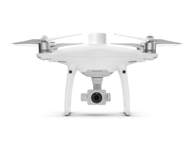
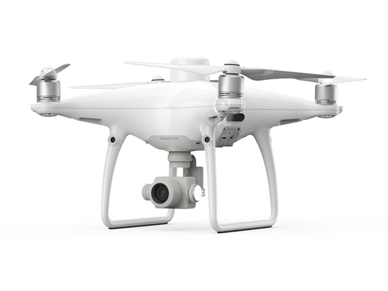
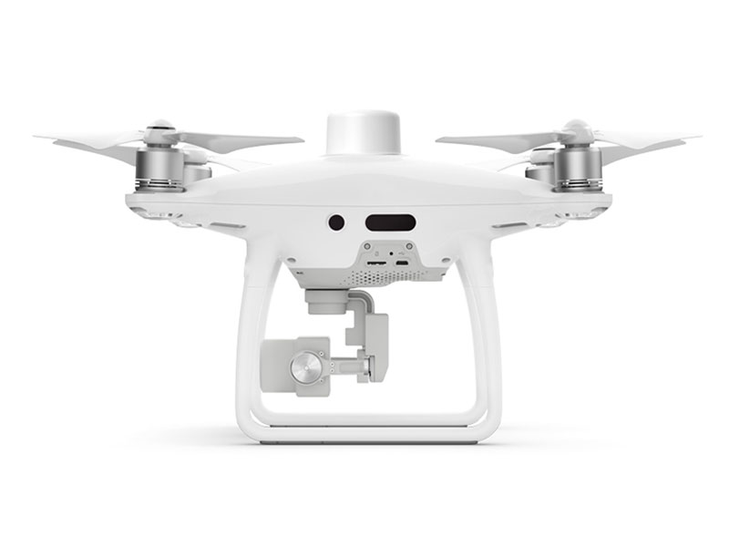
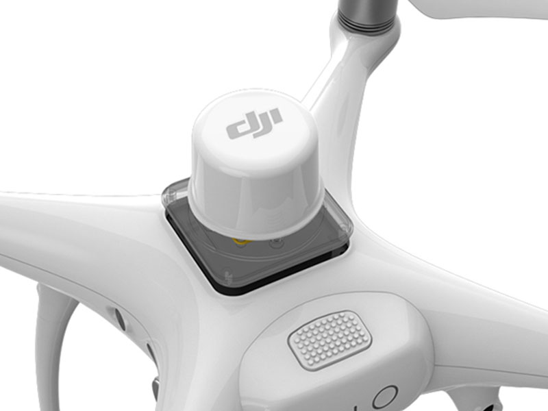
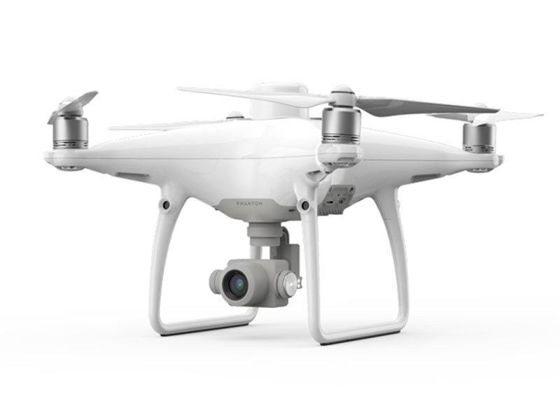

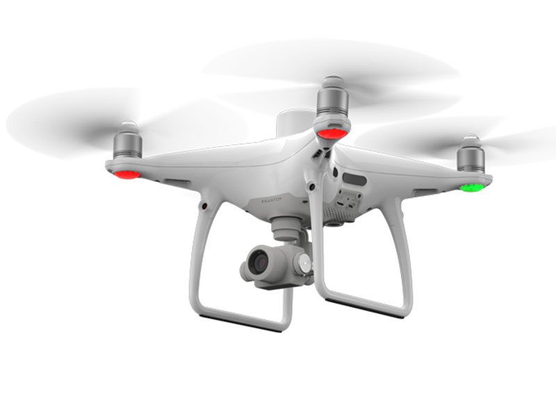
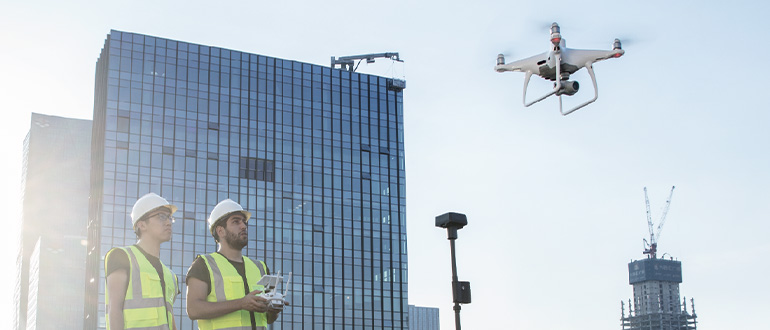
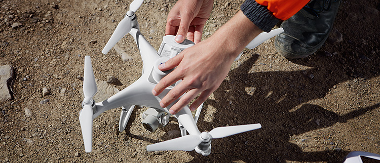
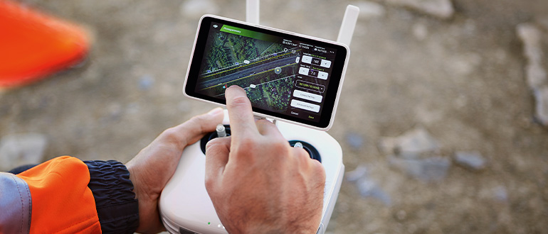
DJI has revolutionized aerial mapping with the Phantom 4 RTK. This aircraft gives you centimetre accurate data as well as easy and intuitive software. This is perfect for beginner to professional mappers! The aircraft is also under 2kgs making it compact and versatile enough to take on any site. Intelligent features such as GS RTK flight planning as well as OcuSync and D-RTK 2 integration make DJI Phantom 4 RTK a go to solution for accurate and reliable mapping, surveying and data collection.